
Weermodellen
De gegevens in de weersverwachting API's zijn afkomstig uit grootschalige weermodellen. Meteoserver verwerkt deze ruwe weerdata 24/7 tot snelle Weer API's. Klik op onderstaande namen om meer te lezen over deze weermodellen.
Het KNMI beschikt over twee eigen weermodellen, het High Resolution Limited Area Model (HIRLAM) en HARMONIE (HIRLAM ALADIN Research on Mesoscale Operational NWP in Euromed). Deze weermodellen zijn speciaal voor korte termijn weersverwachtingen ontwikkeld en leveren deze tot 48 uur vooruit. Vraag je een uurverwachting op, dan krijg je als het een Europese locatie betreft een HiRLAM modelverwachting.
Lijst met HiRLAM variabelen
Mocht je bepaalde gegevens in een custom API willen opvragen, laat het weten. We bouwen deze graag!
ALBDO0m 0 84,105,0 ** 0 m above ground Albedo [%]
APCP0m 0 61,105,0 ** 0 m above ground Total precipitation [kg/m^2]
DPT2m 0 17,105,2 ** 2 m above ground Dew point temp. [K]
GRAD0m 0 117,105,0 ** 0 m above ground Global radiation [W/m^2]
HCDC0m 0 75,105,0 ** 0 m above ground High level cloud cover [%]
LCDC0m 0 73,105,0 ** 0 m above ground Low level cloud cover [%]
LFTX0m 0 131,105,0 ** 0 m above ground Surface lifted index [K]
LHTFL0m 0 121,105,0 ** 0 m above ground Latent heat flux [W/m^2]
MCDC0m 0 74,105,0 ** 0 m above ground Mid level cloud cover [%]
MIXHT0m 0 67,105,0 ** 0 m above ground Mixed layer depth [m]
NCPCP0m 0 62,105,0 ** 0 m above ground Large scale precipitation [kg/m^2]
NLWRS0m 0 112,105,0 ** 0 m above ground Net long wave (surface) [W/m^2]
NSWRS0m 0 111,105,0 ** 0 m above ground Net short wave (surface) [W/m^2]
PRES0m 0 1,103,0 ** 0 m above msl Pressure [Pa]
SHTFL0m 0 122,105,0 ** 0 m above ground Sensible heat flux [W/m^2]
SNOD0m 0 66,105,0 ** 0 m above ground Snow depth [m]
TCDC0m 0 71,105,0 ** 0 m above ground Total cloud cover [%]
TMPhag 2 11,105,0 ** (profile) Temp. [K]
UGRD10m 0 33,105,10 ** 10 m above ground u wind [m/s]
VGRD10m 0 34,105,10 ** 10 m above ground v wind [m/s]
WEASD0m 0 65,105,0 ** 0 m above ground Accum. snow [kg/m^2]
Het HARMONIE (HIRLAM ALADIN Research on Mesoscale Operational NWP in Euromed) weermodel van het KNMI heeft een grid dat alleen de Benelux omvat. Echter is deze bijzonder dicht: de gridpunten liggen slechts 2,5 kiloneter van elkaar. Voor heel Nederland zijn dat ruim 10000 vlakken. Dat zorgt ervoor dat de verwachting uit het Harmoniemodel waarlijk hyperlokaal is. Vraag je een Nederlandse locatie op met de uurverwachting API, dan krijg je dus Harmonie modeluitvoer geleverd.
Lijst met Harmonie variabelen
Mocht je bepaalde gegevens in een custom API willen opvragen, laat het weten. We bouwen deze graag!
ACPCPhag 2 63,105,0 ** (profile) Convective precipitation [kg/m^2]
APCPhag 2 61,105,0 ** (profile) Total precipitation [kg/m^2]
BRTMPtoa 0 118,8,0 ** top of atmos Brightness temperature [K]
CSDLF10m 0 163,105,10 ** 10 m above ground Clear sky downward long wave flux [W/m^2]
CSULF10m 0 162,105,10 ** 10 m above ground Clear sky upward long wave flux [W/m^2]
GRAD0m 0 117,105,0 ** 0 m above ground Global radiation [W/m^2]
HCDC0m 0 75,105,0 ** 0 m above ground High level cloud cover [%]
ICWAT458m 0 201,105,458 ** 458 m above ground Ice-free water surface [%]
LCDC0m 0 73,105,0 ** 0 m above ground Low level cloud cover [%]
LHTFL0m 0 121,105,0 ** 0 m above ground Latent heat flux [W/m^2]
MCDC0m 0 74,105,0 ** 0 m above ground Mid level cloud cover [%]
MIXHT0m 0 67,105,0 ** 0 m above ground Mixed layer depth [m]
NCPCPhag 2 62,105,0 ** (profile) Large scale precipitation [kg/m^2]
NLWRS0m 0 112,105,0 ** 0 m above ground Net long wave (surface) [W/m^2]
NSWRS0m 0 111,105,0 ** 0 m above ground Net short wave (surface) [W/m^2]
PRES0m 0 1,103,0 ** 0 m above msl Pressure [Pa]
RH2m 0 52,105,2 ** 2 m above ground Relative humidity [%]
SHTFL0m 0 122,105,0 ** 0 m above ground Sensible heat flux [W/m^2]
SNOD0m 0 66,105,0 ** 0 m above ground Snow depth [m]
SSRUN0m 0 235,105,0 ** 0 m above ground Storm surface runoff [kg/m^2]
TCDC0m 0 71,105,0 ** 0 m above ground Total cloud cover [%]
TMP2m 0 11,105,2 ** 2 m above ground Temp. [K]
UGRD10m 0 33,105,10 ** 10 m above ground u wind [m/s]
VGRD10m 0 34,105,10 ** 10 m above ground v wind [m/s]
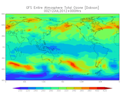
Het Global Forecasting System (GFS) is het weermodel van het Amerikaanse National Centre for Environmental Prediction (NCEP). Via deze dataset zijn tientallen atmosferische en land-bodemvariabelen beschikbaar, van temperaturen, wind en neerslag tot bodemvocht en atmosferische ozonconcentratie. De hele wereld wordt gedekt door het GFS met een horizontale basisresolutie van 28 kilometer tussen de rasterpunten. Het grote voordeel van het GFS is niet alleen de wereldwijde dekking, maar ook de beschikbaarheid van modeldata tot 14 dagen in de toekomst. De horizontale resolutie daalt overigens wel naar 70 kilometer tussen de rasterpunten voor verwachtingen tussen één en twee weken vooruit.
<
Lijst met GFS variabelen
Mocht je bepaalde gegevens in een custom API willen opvragen, laat het weten. We bouwen deze graag!
absvprs=>absvprs 31 t,z,y,x ** (1000 975 950 925 900.. 70 50 30 20 10) absolute vorticity [1/s]
no4lftxsfc=>no4lftxsfc 0 t,y,x ** surface best (4 layer) lifted index [k]
no5wavh500mb=>no5wavh500mb 0 t,y,x ** 500 mb 5-wave geopotential height [gpm]
acpcpsfc=>acpcpsfc 0 t,y,x ** surface convective precipitation [kg/m^2]
albdosfc=>albdosfc 0 t,y,x ** surface albedo [%]
apcpsfc=>apcpsfc 0 t,y,x ** surface total precipitation [kg/m^2]
capesfc=>capesfc 0 t,y,x ** surface convective available potential energy [j/kg]
cape180_0mb=>cape180_0mb 0 t,y,x ** 180-0 mb above ground convective available potential energy [j/kg]
cape255_0mb=>cape255_0mb 0 t,y,x ** 255-0 mb above ground convective available potential energy [j/kg]
cfrzrsfc=>cfrzrsfc 0 t,y,x ** surface categorical freezing rain [-]
cicepsfc=>cicepsfc 0 t,y,x ** surface categorical ice pellets [-]
cinsfc=>cinsfc 0 t,y,x ** surface convective inhibition [j/kg]
cin180_0mb=>cin180_0mb 0 t,y,x ** 180-0 mb above ground convective inhibition [j/kg]
cin255_0mb=>cin255_0mb 0 t,y,x ** 255-0 mb above ground convective inhibition [j/kg]
clwmrprs=>clwmrprs 31 t,z,y,x ** (1000 975 950 925 900.. 300 250 200 150 100) cloud mixing ratio [kg/kg]
cpofpsfc=>cpofpsfc 0 t,y,x ** surface percent frozen precipitation [%]
cpratsfc=>cpratsfc 0 t,y,x ** surface convective precipitation rate [kg/m^2/s]
crainsfc=>crainsfc 0 t,y,x ** surface categorical rain [-]
csnowsfc=>csnowsfc 0 t,y,x ** surface categorical snow [-]
cwatclm=>cwatclm 0 t,y,x ** entire atmosphere (considered as a single layer) cloud water [kg/m^2]
cworkclm=>cworkclm 0 t,y,x ** entire atmosphere (considered as a single layer) cloud work function [j/kg]
dlwrfsfc=>dlwrfsfc 0 t,y,x ** surface downward long-wave rad. flux [w/m^2]
dpt2m=>dpt2m 0 t,y,x ** 2 m above ground dew point temperature [k]
dswrfsfc=>dswrfsfc 0 t,y,x ** surface downward short-wave radiation flux [w/m^2]
fldcpsfc=>fldcpsfc 0 t,y,x ** surface field capacity [fraction]
gfluxsfc=>gfluxsfc 0 t,y,x ** surface ground heat flux [w/m^2]
gustsfc=>gustsfc 0 t,y,x ** surface wind speed (gust) [m/s]
hgtsfc=>hgtsfc 0 t,y,x ** surface geopotential height [gpm]
hgtprs=>hgtprs 31 t,z,y,x ** (1000 975 950 925 900.. 7 5 3 2 1) geopotential height [gpm]
hgt2pv=>hgt2pv 0 t,y,x ** pv=2e-06 (km^2/kg/s) surface geopotential height [gpm]
hgtneg2pv=>hgtneg2pv 0 t,y,x ** pv=-2e-06 (km^2/kg/s) surface geopotential height [gpm]
hgttop0c=>hgttop0c 0 t,y,x ** highest tropospheric freezing level geopotential height [gpm]
hgt0c=>hgt0c 0 t,y,x ** 0c isotherm geopotential height [gpm]
hgtmwl=>hgtmwl 0 t,y,x ** max wind geopotential height [gpm]
hgttrop=>hgttrop 0 t,y,x ** tropopause geopotential height [gpm]
hindexsfc=>hindexsfc 0 t,y,x ** surface haines index [numeric]
hlcy3000_0m=>hlcy3000_0m 0 t,y,x ** 3000-0 m above ground storm relative helicity [m^2/s^2]
hpblsfc=>hpblsfc 0 t,y,x ** surface planetary boundary layer height [m]
icahtmwl=>icahtmwl 0 t,y,x ** max wind icao standard atmosphere reference height [m]
icahttrop=>icahttrop 0 t,y,x ** tropopause icao standard atmosphere reference height [m]
icecsfc=>icecsfc 0 t,y,x ** surface ice cover [proportion]
icsevprs=>icsevprs 31 t,z,y,x ** (1000 950 900 850 800.. 300 250 200 150 100) icing severity [non-dim]
landsfc=>landsfc 0 t,y,x ** surface land cover (0=sea, 1=land) [proportion]
landnsfc=>landnsfc 0 t,y,x ** surface land-sea coverage (nearest neighbor) [land=1,sea=0] [-]
lftxsfc=>lftxsfc 0 t,y,x ** surface surface lifted index [k]
lhtflsfc=>lhtflsfc 0 t,y,x ** surface latent heat net flux [w/m^2]
msletmsl=>msletmsl 0 t,y,x ** mean sea level mslp (eta model reduction) [pa]
o3mrprs=>o3mrprs 31 t,z,y,x ** (400 350 300 250 200.. 7 5 3 2 1) ozone mixing ratio [kg/kg]
pevprsfc=>pevprsfc 0 t,y,x ** surface potential evaporation rate [w/m^2]
plpl255_0mb=>plpl255_0mb 0 t,y,x ** 255-0 mb above ground pressure of level from which parcel was lifted [pa]
potsig995=>potsig995 0 t,y,x ** 0.995 sigma level potential temperature [k]
pratesfc=>pratesfc 0 t,y,x ** surface precipitation rate [kg/m^2/s]
preslclb=>preslclb 0 t,y,x ** low cloud bottom level pressure [pa]
preslclt=>preslclt 0 t,y,x ** low cloud top level pressure [pa]
presmclb=>presmclb 0 t,y,x ** middle cloud bottom level pressure [pa]
presmclt=>presmclt 0 t,y,x ** middle cloud top level pressure [pa]
preshclb=>preshclb 0 t,y,x ** high cloud bottom level pressure [pa]
preshclt=>preshclt 0 t,y,x ** high cloud top level pressure [pa]
pressfc=>pressfc 0 t,y,x ** surface pressure [pa]
pres80m=>pres80m 0 t,y,x ** 80 m above ground pressure [pa]
pres2pv=>pres2pv 0 t,y,x ** pv=2e-06 (km^2/kg/s) surface pressure [pa]
presneg2pv=>presneg2pv 0 t,y,x ** pv=-2e-06 (km^2/kg/s) surface pressure [pa]
prescclb=>prescclb 0 t,y,x ** convective cloud bottom level pressure [pa]
prescclt=>prescclt 0 t,y,x ** convective cloud top level pressure [pa]
presmwl=>presmwl 0 t,y,x ** max wind pressure [pa]
prestrop=>prestrop 0 t,y,x ** tropopause pressure [pa]
prmslmsl=>prmslmsl 0 t,y,x ** mean sea level pressure reduced to msl [pa]
pwatclm=>pwatclm 0 t,y,x ** entire atmosphere (considered as a single layer) precipitable water [kg/m^2]
rhprs=>rhprs 31 t,z,y,x ** (1000 975 950 925 900.. 7 5 3 2 1) relative humidity [%]
rh2m=>rh2m 0 t,y,x ** 2 m above ground relative humidity [%]
rhsg330_1000=>rhsg330_1000 0 t,y,x ** 0.33-1 sigma layer relative humidity [%]
rhsg440_1000=>rhsg440_1000 0 t,y,x ** 0.44-1 sigma layer relative humidity [%]
rhsg720_940=>rhsg720_940 0 t,y,x ** 0.72-0.94 sigma layer relative humidity [%]
rhsg440_720=>rhsg440_720 0 t,y,x ** 0.44-0.72 sigma layer relative humidity [%]
rhsig995=>rhsig995 0 t,y,x ** 0.995 sigma level relative humidity [%]
rh30_0mb=>rh30_0mb 0 t,y,x ** 30-0 mb above ground relative humidity [%]
rhclm=>rhclm 0 t,y,x ** entire atmosphere (considered as a single layer) relative humidity [%]
rhtop0c=>rhtop0c 0 t,y,x ** highest tropospheric freezing level relative humidity [%]
rh0c=>rh0c 0 t,y,x ** 0c isotherm relative humidity [%]
shtflsfc=>shtflsfc 0 t,y,x ** surface sensible heat net flux [w/m^2]
snodsfc=>snodsfc 0 t,y,x ** surface snow depth [m]
soilw0_10cm=>soilw0_10cm 0 t,y,x ** 0-0.1 m below ground volumetric soil moisture content [fraction]
soilw10_40cm=>soilw10_40cm 0 t,y,x ** 0.1-0.4 m below ground volumetric soil moisture content [fraction]
soilw40_100cm=>soilw40_100cm 0 t,y,x ** 0.4-1 m below ground volumetric soil moisture content [fraction]
soilw100_200cm=>soilw100_200cm 0 t,y,x ** 1-2 m below ground volumetric soil moisture content [fraction]
spfh2m=>spfh2m 0 t,y,x ** 2 m above ground specific humidity [kg/kg]
spfh80m=>spfh80m 0 t,y,x ** 80 m above ground specific humidity [kg/kg]
spfh30_0mb=>spfh30_0mb 0 t,y,x ** 30-0 mb above ground specific humidity [kg/kg]
sunsdsfc=>sunsdsfc 0 t,y,x ** surface sunshine duration [s]
tcdcclm=>tcdcclm 0 t,y,x ** entire atmosphere total cloud cover [%]
tcdcblcll=>tcdcblcll 0 t,y,x ** boundary layer cloud layer total cloud cover [%]
tcdclcll=>tcdclcll 0 t,y,x ** low cloud layer total cloud cover [%]
tcdcmcll=>tcdcmcll 0 t,y,x ** middle cloud layer total cloud cover [%]
tcdchcll=>tcdchcll 0 t,y,x ** high cloud layer total cloud cover [%]
tcdcccll=>tcdcccll 0 t,y,x ** convective cloud layer total cloud cover [%]
tmax2m=>tmax2m 0 t,y,x ** 2 m above ground maximum temperature [k]
tmin2m=>tmin2m 0 t,y,x ** 2 m above ground minimum temperature [k]
tmplclt=>tmplclt 0 t,y,x ** low cloud top level temperature [k]
tmpmclt=>tmpmclt 0 t,y,x ** middle cloud top level temperature [k]
tmphclt=>tmphclt 0 t,y,x ** high cloud top level temperature [k]
tmpsfc=>tmpsfc 0 t,y,x ** surface temperature [k]
tmpprs=>tmpprs 31 t,z,y,x ** (1000 975 950 925 900.. 7 5 3 2 1) temperature [k]
tmp_1829m=>tmp_1829m 0 t,y,x ** 1829 m above mean sea level temperature [k]
tmp_2743m=>tmp_2743m 0 t,y,x ** 2743 m above mean sea level temperature [k]
tmp_3658m=>tmp_3658m 0 t,y,x ** 3658 m above mean sea level temperature [k]
tmp2m=>tmp2m 0 t,y,x ** 2 m above ground temperature [k]
tmp80m=>tmp80m 0 t,y,x ** 80 m above ground temperature [k]
tmp100m=>tmp100m 0 t,y,x ** 100 m above ground temperature [k]
tmpsig995=>tmpsig995 0 t,y,x ** 0.995 sigma level temperature [k]
tmp30_0mb=>tmp30_0mb 0 t,y,x ** 30-0 mb above ground temperature [k]
tmp2pv=>tmp2pv 0 t,y,x ** pv=2e-06 (km^2/kg/s) surface temperature [k]
tmpneg2pv=>tmpneg2pv 0 t,y,x ** pv=-2e-06 (km^2/kg/s) surface temperature [k]
tmpmwl=>tmpmwl 0 t,y,x ** max wind temperature [k]
tmptrop=>tmptrop 0 t,y,x ** tropopause temperature [k]
tozneclm=>tozneclm 0 t,y,x ** entire atmosphere (considered as a single layer) total ozone [du]
tsoil0_10cm=>tsoil0_10cm 0 t,y,x ** 0-0.1 m below ground soil temperature validation to deprecate [k]
tsoil10_40cm=>tsoil10_40cm 0 t,y,x ** 0.1-0.4 m below ground soil temperature validation to deprecate [k]
tsoil40_100cm=>tsoil40_100cm 0 t,y,x ** 0.4-1 m below ground soil temperature validation to deprecate [k]
tsoil100_200cm=>tsoil100_200cm 0 t,y,x ** 1-2 m below ground soil temperature validation to deprecate [k]
ugwdsfc=>ugwdsfc 0 t,y,x ** surface zonal flux of gravity wave stress [n/m^2]
uflxsfc=>uflxsfc 0 t,y,x ** surface momentum flux, u-component [n/m^2]
ugrdprs=>ugrdprs 31 t,z,y,x ** (1000 975 950 925 900.. 7 5 3 2 1) u-component of wind [m/s]
ugrd_1829m=>ugrd_1829m 0 t,y,x ** 1829 m above mean sea level u-component of wind [m/s]
ugrd_2743m=>ugrd_2743m 0 t,y,x ** 2743 m above mean sea level u-component of wind [m/s]
ugrd_3658m=>ugrd_3658m 0 t,y,x ** 3658 m above mean sea level u-component of wind [m/s]
ugrd10m=>ugrd10m 0 t,y,x ** 10 m above ground u-component of wind [m/s]
ugrd80m=>ugrd80m 0 t,y,x ** 80 m above ground u-component of wind [m/s]
ugrd100m=>ugrd100m 0 t,y,x ** 100 m above ground u-component of wind [m/s]
ugrdsig995=>ugrdsig995 0 t,y,x ** 0.995 sigma level u-component of wind [m/s]
ugrd30_0mb=>ugrd30_0mb 0 t,y,x ** 30-0 mb above ground u-component of wind [m/s]
ugrd2pv=>ugrd2pv 0 t,y,x ** pv=2e-06 (km^2/kg/s) surface u-component of wind [m/s]
ugrdneg2pv=>ugrdneg2pv 0 t,y,x ** pv=-2e-06 (km^2/kg/s) surface u-component of wind [m/s]
ugrdpbl=>ugrdpbl 0 t,y,x ** planetary boundary layer u-component of wind [m/s]
ugrdmwl=>ugrdmwl 0 t,y,x ** max wind u-component of wind [m/s]
ugrdtrop=>ugrdtrop 0 t,y,x ** tropopause u-component of wind [m/s]
ulwrfsfc=>ulwrfsfc 0 t,y,x ** surface upward long-wave rad. flux [w/m^2]
ulwrftoa=>ulwrftoa 0 t,y,x ** top of atmosphere upward long-wave rad. flux [w/m^2]
ustm6000_0m=>ustm6000_0m 0 t,y,x ** 6000-0 m above ground u-component storm motion [m/s]
uswrfsfc=>uswrfsfc 0 t,y,x ** surface upward short-wave radiation flux [w/m^2]
uswrftoa=>uswrftoa 0 t,y,x ** top of atmosphere upward short-wave radiation flux [w/m^2]
vgwdsfc=>vgwdsfc 0 t,y,x ** surface meridional flux of gravity wave stress [n/m^2]
vflxsfc=>vflxsfc 0 t,y,x ** surface momentum flux, v-component [n/m^2]
vgrdprs=>vgrdprs 31 t,z,y,x ** (1000 975 950 925 900.. 7 5 3 2 1) v-component of wind [m/s]
vgrd_1829m=>vgrd_1829m 0 t,y,x ** 1829 m above mean sea level v-component of wind [m/s]
vgrd_2743m=>vgrd_2743m 0 t,y,x ** 2743 m above mean sea level v-component of wind [m/s]
vgrd_3658m=>vgrd_3658m 0 t,y,x ** 3658 m above mean sea level v-component of wind [m/s]
vgrd10m=>vgrd10m 0 t,y,x ** 10 m above ground v-component of wind [m/s]
vgrd80m=>vgrd80m 0 t,y,x ** 80 m above ground v-component of wind [m/s]
vgrd100m=>vgrd100m 0 t,y,x ** 100 m above ground v-component of wind [m/s]
vgrdsig995=>vgrdsig995 0 t,y,x ** 0.995 sigma level v-component of wind [m/s]
vgrd30_0mb=>vgrd30_0mb 0 t,y,x ** 30-0 mb above ground v-component of wind [m/s]
vgrd2pv=>vgrd2pv 0 t,y,x ** pv=2e-06 (km^2/kg/s) surface v-component of wind [m/s]
vgrdneg2pv=>vgrdneg2pv 0 t,y,x ** pv=-2e-06 (km^2/kg/s) surface v-component of wind [m/s]
vgrdpbl=>vgrdpbl 0 t,y,x ** planetary boundary layer v-component of wind [m/s]
vgrdmwl=>vgrdmwl 0 t,y,x ** max wind v-component of wind [m/s]
vgrdtrop=>vgrdtrop 0 t,y,x ** tropopause v-component of wind [m/s]
vissfc=>vissfc 0 t,y,x ** surface visibility [m]
vratepbl=>vratepbl 0 t,y,x ** planetary boundary layer ventilation rate [m^2/s]
vstm6000_0m=>vstm6000_0m 0 t,y,x ** 6000-0 m above ground v-component storm motion [m/s]
vvelprs=>vvelprs 31 t,z,y,x ** (1000 975 950 925 900.. 300 250 200 150 100) vertical velocity (pressure) [pa/s]
vvelsig995=>vvelsig995 0 t,y,x ** 0.995 sigma level vertical velocity (pressure) [pa/s]
vwsh2pv=>vwsh2pv 0 t,y,x ** pv=2e-06 (km^2/kg/s) surface vertical speed shear [1/s]
vwshneg2pv=>vwshneg2pv 0 t,y,x ** pv=-2e-06 (km^2/kg/s) surface vertical speed shear [1/s]
vwshtrop=>vwshtrop 0 t,y,x ** tropopause vertical speed shear [1/s]
watrsfc=>watrsfc 0 t,y,x ** surface water runoff [kg/m^2]
weasdsfc=>weasdsfc 0 t,y,x ** surface water equivalent of accumulated snow depth [kg/m^2]
wiltsfc=>wiltsfc 0 t,y,x ** surface wilting point [fraction]
var00212m=>var00212m 0 t,y,x ** 2 m above ground desc [unit]
EWAM (European Wave Model) is een bijzonder weermodel, deze wordt door de supercomputers van de Deutscher Wetterdienst DWD gegenereerd. Het EWAM-model geeft een verwachting voor de golfhoogte, -periode en -richting in onder meer de Noordzee. Wanneer je een maritieme API gebruikt krijg je aldus de gegevens uit dit model te zien, gecombineerd met atmosferische data uit het Harmonie-model.